
Community asset
mapping for
better decisions.

Crossweave helps councils, not-for-profits and community organisations map local services, groups, places and the relationships between them. See what’s available, identify gaps in support and plan where to focus your efforts.

Piloting with Wyndham City Council

Paper Giant Wyndham City Council

See more than assets.
See what connects them.

Every community has people, places and services it relies on. Crossweave brings them — and their relationships — into one shared picture.

Build on what’s working, see the gaps, and plan for the places you serve.

Local knowledge.
A whole new perspective.

Move from a list of what exists to a clearer understanding of how your community works.

One place for
what matters.

Bring organisations, services, groups and places into a register your team can keep up to date.

  • Rich profiles with classifications and connections
  • Filters for area, community and population needs
  • Verification status and data freshness
  • CSV import, validation and export
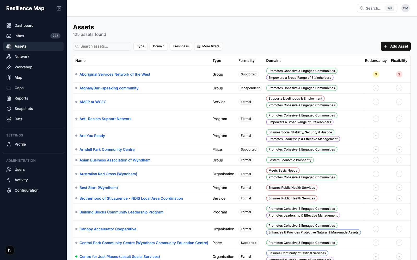
The actual asset register, with organisations and community groups, type and domain labels, and resilience scores.

The relationships
behind resilience.

Explore the connections between community assets, from referral pathways to partnerships and shared resources.

  • Interactive network with asset focus mode
  • Connection types, strength and direction
  • Filters to explore a part of the network
  • Read-only network share links
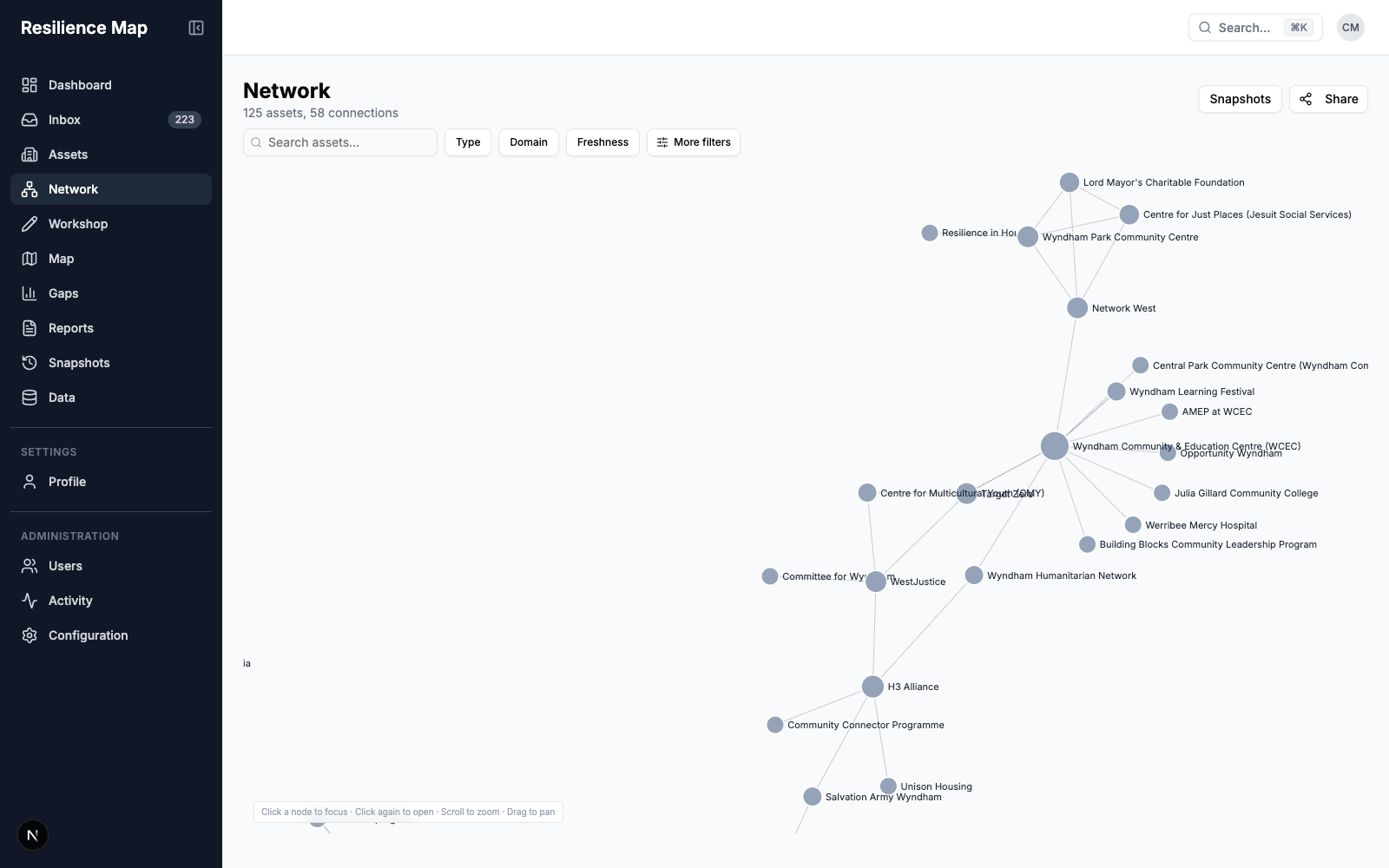
The pilot network graph showing connections between Wyndham community organisations, services and groups.

Understand
the places you serve.

See where your assets are and explore their coverage across the areas your council plans for.

  • Geographic asset map with clustering
  • Colour by domain or resilience score
  • Filters that connect map and register
  • ABS Census need layers, where configured
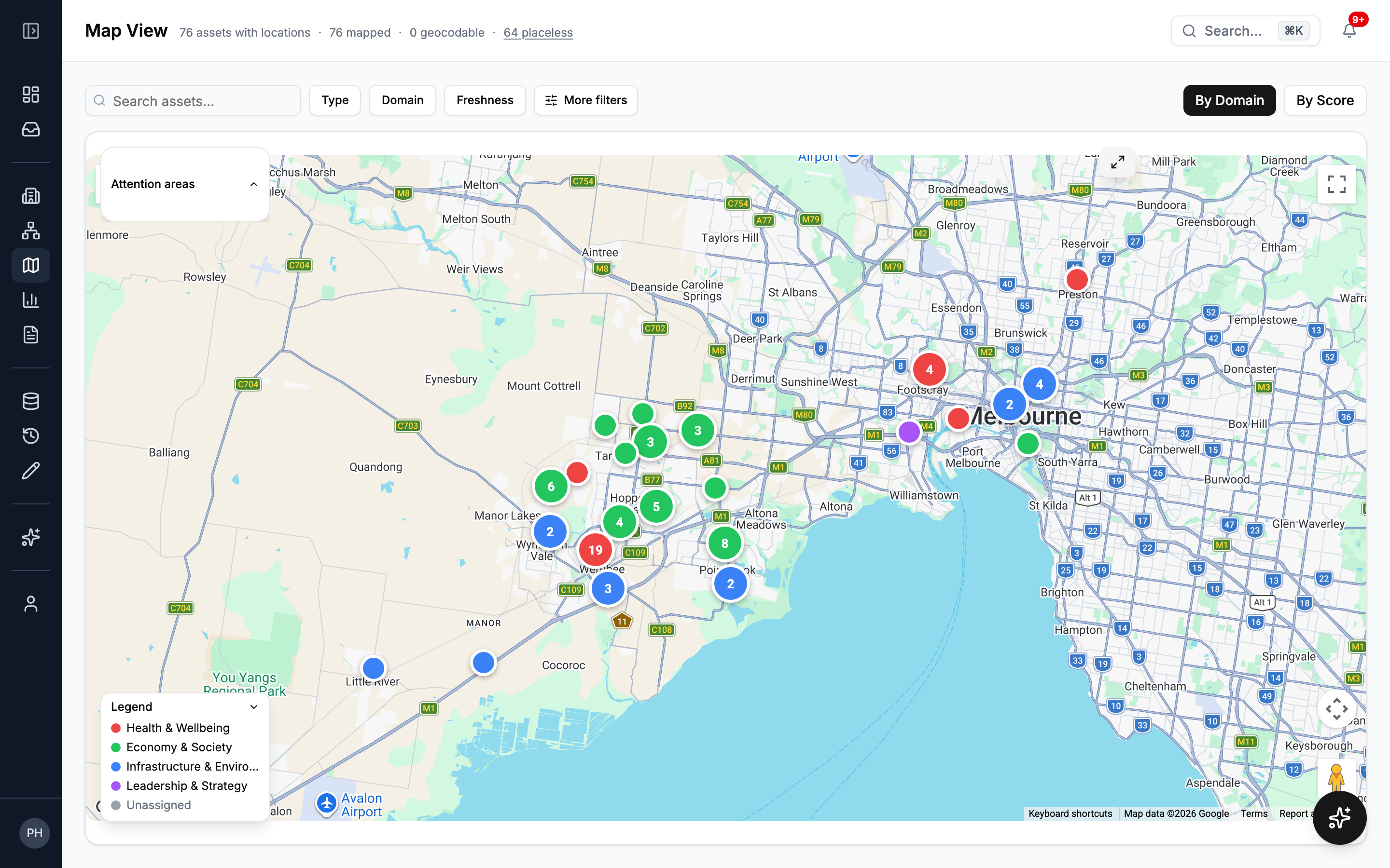
The live pilot’s map showing geographic coverage of community assets across Wyndham, with colour-coded clusters, a domain legend and map controls.

Make the most
of the room.

Capture what people know in a facilitator-led mapping session, and make it part of your community’s living register.

  • Drag assets onto a visual workshop canvas
  • Draw and describe relationships
  • Record changes under a named session
  • Review and revert session changes
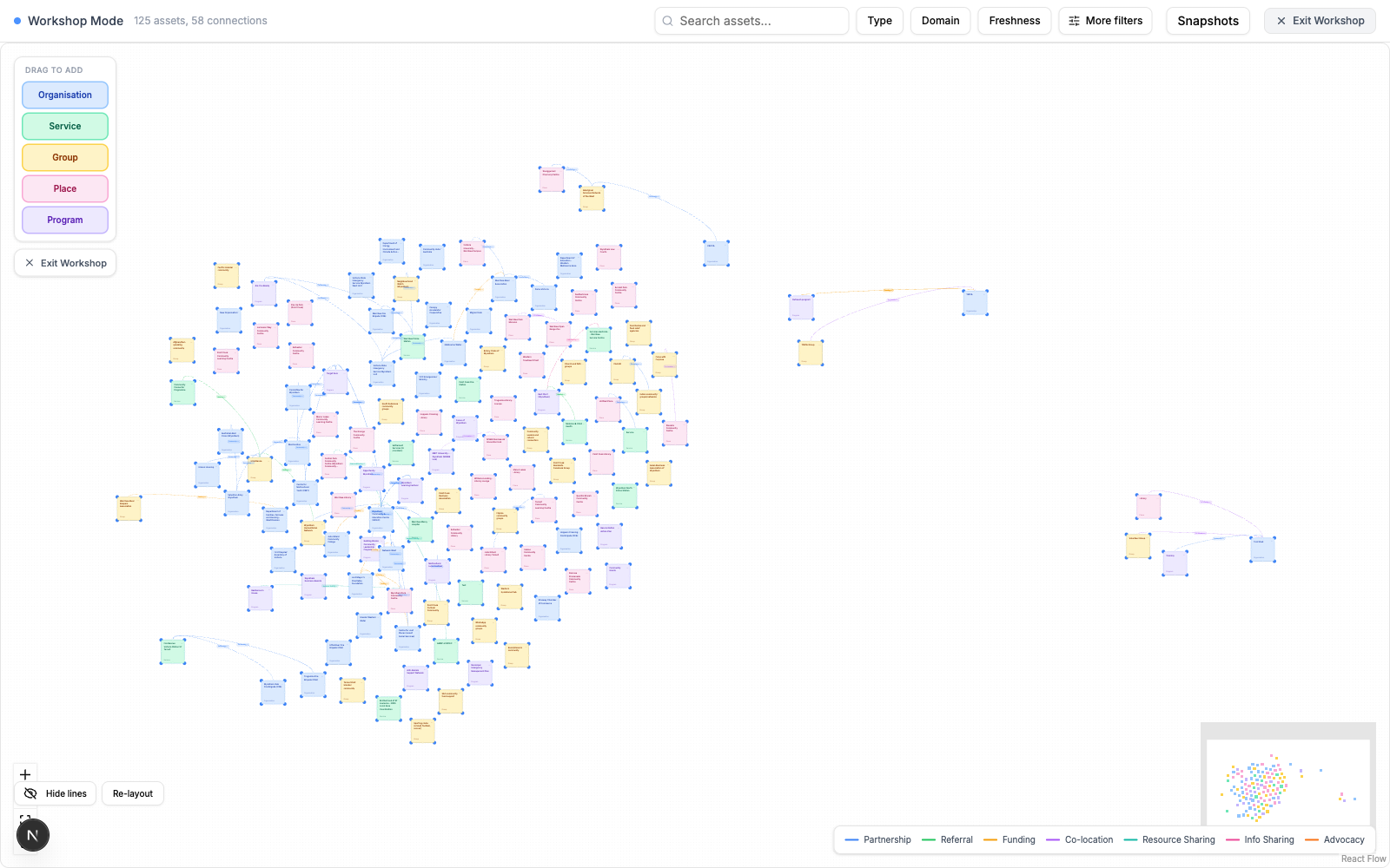
The real workshop canvas, with coloured organisation, service, group, place and program cards linked by relationship lines.

A clearer picture.
A more confident next step.

Use the evidence you’ve brought together to guide decisions, share findings and keep the work moving.

Find the gaps that matter.

Explore coverage across areas, resilience qualities and population groups. Follow findings back to the data and add priorities to your team’s inbox.

Put your evidence to work.

Build reports with summaries, charts, asset listings, gap analysis and data quality. Preview the result, then export a PDF for your next conversation.

Keep judgement in your hands.

Optional AI scoring offers a score and a rationale. Officer assessments and notes stay separate, and your council controls whether AI features are enabled.

Local knowledge is
your strongest starting point.

Crossweave is being piloted with Wyndham City Council, bringing community knowledge and council insight into the same picture. We’re building a practical tool for the people working to make their communities stronger.

A stronger tomorrow.
Together.

Interested in what Crossweave could mean for your council or community?

We’re piloting with Wyndham City Council and will be taking on more pilot partners in October 2026. Leave your details and we’ll be in touch.

Register your interest

Thanks. You’re on the list.

We’ll be in touch about Crossweave and opportunities to join the pilot.

We’ll only use your details to get in touch about Crossweave.